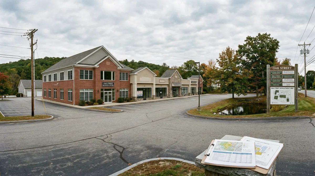
"Location, location, location" is the most repeated line in this business, and the one people apply the least rigorously. Most buyers and tenants judge a location by feel: "it looks busy," "it feels like a good area," "I drive past it every day." That gets you by until it doesn't. A location analysis built on data instead of instinct is what separates the deals that work from the ones that cost you.
Traffic counts: Average Daily Traffic (ADT) is the single most important number for a retail site; Route 9 in Spencer runs 16,000+ ADT against under 5,000 on secondary roads.
Demographics: A 15-minute drive-time trade area, not a circle drawn on a map, is what tells you the real customer base for retail and service space.
Accessibility and visibility: Properties with 4+ access points, signage visible from 500+ feet, and pylon sign rights lease 15-30% higher than comparable spaces.
Zoning is destiny: Worcester's 4,563+ commercially zoned parcels fall into 13 business and manufacturing classifications, each with its own permitted uses.
Trade Area is the geographic region a commercial property draws most of its customers or tenants from. For retail, the primary trade area is usually a 10-15 minute drive time, not a fixed-radius circle, because drive time accounts for the road network, traffic, and natural barriers that a straight-line distance ignores.
16,000+ ADT on Route 9 in Spencer against under 5,000 on secondary roads, a 3x-plus traffic gap that shows up directly in retail revenue.
15-minute drive time is the standard primary trade area for neighborhood retail; 25-30 minutes for destination retail and regional shopping centers.
4,563+ commercially zoned parcels across Worcester's 13 business and manufacturing district classifications, each with its own permitted uses.
76% of Worcester's commercial buildings went up before 1980, which makes building condition and code compliance factors you can't skip.
The seven categories I score, weighted by property type
Site selection comes down to seven categories, and they carry different weight depending on what you're putting there:
| Factor | Retail Weight | Industrial Weight | Office Weight |
|---|---|---|---|
| Demographics and population | High | Low | Medium |
| Traffic counts and patterns | High | Medium | Medium |
| Accessibility and ingress/egress | High | High | Medium |
| Visibility and signage | High | Low | Low |
| Competition and co-tenancy | High | Low | Medium |
| Zoning and land use | Medium | High | High |
| Infrastructure and growth | Medium | High | Medium |
Factor 1: Demographics and population
What to look at
- Population within the trade area: Total residents inside a 5, 10, and 15-minute drive time
- Household income: Median and the spread. 20,000 households earning $85,000+ support very different tenants than 20,000 households at $45,000
- Age distribution: Drives demand for medical offices, restaurants, fitness, childcare, and senior services
- Daytime population: Office workers, students, and hospital staff who shop and eat near where they work
- Population growth: 5-year and 10-year trends tell you whether demand is expanding or shrinking
What this looks like in Worcester
Worcester has grown to roughly 206,000, New England's second-largest city. The daytime population runs much higher because of the institutions: UMass Memorial Health Care (13,000+ employees), WPI, Clark University, College of the Holy Cross, and the biotech cluster building up around the Medical/Academic campus.
The Canal District, the most active submarket in the city right now, pulls from a 15-minute trade area of roughly 180,000 residents and 75,000+ daytime workers. That's the densest concentration of demand in Central Massachusetts.
Factor 2: Traffic counts and patterns
MassDOT publishes traffic counts free for every state-maintained road in Massachusetts. The numbers that matter for commercial real estate:
- Average Daily Traffic (ADT): Total vehicle trips past a point in 24 hours
- Peak-hour traffic: The busiest hour, usually 4-6 PM for retail, 7-9 AM for office
- Directional split: A road at 16,000 ADT split 50/50 gives you 8,000 vehicles each way, and a median-divided road with limited U-turn access effectively cuts your exposure in half
- Speed: Traffic at 25-35 MPH gives drivers time to read your sign and turn in; traffic at 55+ MPH doesn't
Central Massachusetts traffic benchmarks
| Corridor | ADT | Primary Property Types |
|---|---|---|
| Route 9, Spencer | 16,000+ | Retail, restaurant, service |
| Route 20, Auburn/Oxford | 18,000-22,000 | Retail, auto-oriented, flex |
| Route 12, Oxford | 12,000-15,000 | Industrial, retail, mixed-use |
| I-290 (accessed via exits) | 80,000+ | Industrial, distribution, office |
| Route 131, Southbridge | 8,000-10,000 | Retail, healthcare-adjacent |
| Kelley Square / Madison St, Worcester | 25,000+ | Mixed-use, restaurant, service |
A retail tenant looking at Spencer Shopper's Village on Route 9 is looking at 16,000+ ADT with CVS Pharmacy anchoring the center, and that combination keeps steady foot traffic coming. Put that same tenant on a secondary road in East Brookfield at 3,000 ADT and they'd need a completely different, destination-driven business model to make it work.
Factor 3: Accessibility and ingress/egress
A property can have great traffic counts and still fail if people can't get into it easily. What I check:
- Number of access points: Two minimum; four (two per direction) is what you want for retail
- Turn movements: Can traffic turn left in, or is there a median? Is there a signal?
- Stacking distance: Room for cars waiting to turn without blocking the through lane
- Highway proximity: Distance to the nearest interstate on-ramp, which is critical for industrial
- Truck access: Can a 53-foot trailer get in and out without blocking traffic or tearing up the curb? Critical for industrial and distribution
Industrial access in Worcester County
For industrial, highway access is the whole ballgame. Worcester County sits at the intersection of I-90 (the Mass Pike), I-290, I-190, and I-395, which puts you a direct run from Boston (40 miles), Hartford (60 miles), Providence (40 miles), and the rest of New England.
Industrial tenants and buyers weigh:
- Distance to the interstate: Under 5 miles is ideal; under 2 miles commands premium rent
- Route weight restrictions: Some local roads carry seasonal or permanent weight limits
- Loading: Drive-in doors for light industrial; dock-high loading for distribution
- Clear heights: 16-20 feet for warehousing; 24-30 feet for modern distribution
Factor 4: Visibility and signage
Visibility ties straight to retail revenue. A space you can't see from the road loses a measurable share of the customers who would have stopped:
- Setback: Set back more than 100 feet and you lose visibility; a pylon sign only partly makes up for it
- Signage rights: Confirm what the zoning allows before you sign, because sign bylaws vary a lot town to town
- Building orientation: Does the storefront face the main traffic flow?
- Obstructions: Trees, utility poles, neighboring buildings, and grade changes all block sightlines
- Night visibility: Illuminated sign rights and exterior lighting affect evening and winter traffic
In Worcester the contrast is plain. A restaurant on Shrewsbury Street, the city's Restaurant Row, feeds off concentrated dining demand and foot traffic. The same restaurant on a secondary industrial road two blocks over can struggle even though it's only 500 feet from a busy corridor.
Factor 5: Competition and co-tenancy
Reading retail competition
Being near competitors is often a good thing, not a bad one. Clusters pull more total traffic than a location out on its own. What I want to know:
- Direct competitors within 1, 3, and 5 miles: How many, how established, how well-located?
- Co-tenancy in multi-tenant centers: A CVS anchor drives 500+ visits a day, and the tenants next door share in that
- Market saturation: Is the trade area over-served or underserved for your category?
- Competitor health: Are the nearby competitors doing well, which validates the spot, or closing, which tells you the market's soft?
Industrial competition
For industrial, the competition read is about supply:
- Available inventory: Total SF for lease or sale in the submarket
- Vacancy rate: Worcester County's 4-6% industrial vacancy points to strong demand
- Pipeline: New construction that could add supply
Factor 6: Zoning and land use
Zoning sets what you can build, operate, and expand. In Massachusetts it's entirely local, one bylaw per municipality.
How Worcester's commercial zoning is laid out
Worcester has 4,563+ commercially zoned parcels across 13 classifications:
Business Districts (3,250+ parcels):
- BL-1.0: Limited business (1,420 parcels), neighborhood retail and professional offices
- BG-2.0: General business, retail, restaurant, service, entertainment
- BG-4.0: General business at higher density, multi-story retail and office
- BH-4.0: Highway business, auto-oriented retail, gas stations, drive-throughs
Manufacturing Districts (1,313+ parcels):
- ML-0.5: Light manufacturing, flex space, light assembly, warehousing
- MG-2.0: General manufacturing (688 parcels), industrial, heavy commercial, distribution
- IP-0.33: Industrial park, planned industrial development, modern specs
Before you commit to any location, confirm:
- Your intended use is permitted, either as of right or by special permit
- The property isn't a pre-existing nonconforming use that boxes in expansion
- Parking requirements can be met on-site
- Signage is permitted in the type and size you need
- Future expansion is feasible under the existing zoning
Factor 7: Infrastructure and growth signals
Long-term value tracks where the surrounding area is headed. What to check:
- Municipal water and sewer: Property on town water and sewer is worth more and easier to develop than one on a private well and septic
- Three-phase power: Needed for industrial and a lot of commercial uses
- Broadband/fiber: Increasingly a factor for every property type
- Road improvements: Planned exits, widenings, or intersection upgrades signal growth
- New construction permits: Worcester issued 2,666 commercial building permits in 2024, an 87% jump over the 1,427 in 2020, which tells you development activity is picking up
- New business certificates: Worcester averages 920 new business registrations a year, a steady pipeline of demand for space
- Institutional investment: Hospital expansions, university building programs, and corporate relocations all create sustained demand
Reading the growth signals in Worcester County
The strongest signals in Central Massachusetts right now:
- Polar Park and the Canal District: The ballpark set off $300+ million in adjacent mixed-use development
- UMass Medical School expansion: Ongoing campus growth drives demand for medical office, lab, and supporting retail
- The I-90/I-84 junction in Sturbridge: Tourism and hospitality investment at that interstate crossroads
- Route 9 densification: From Worcester through Leicester, Spencer, and the Brookfields, Route 9 keeps drawing new retail, restaurant, and service tenants
Property-type checklists
Retail: my top 5
- Traffic over 12,000 ADT
- Median household income above $60,000 within a 10-minute drive
- Parking at least 4:1 (4 spaces per 1,000 SF)
- Visibility from the primary road with permitted signage
- Co-tenancy with businesses that complement yours
Industrial: my top 5
- Within 5 miles of interstate access (I-90, I-290, I-190, I-395)
- Loading that fits: dock-high for distribution, drive-in for light industrial
- Clear heights that match the operation (16-30 feet depending on use)
- Three-phase power and enough electrical capacity
- Zoning that permits both today's use and where you might go
Office: my top 5
- Close to the workforce (residential density within a 20-minute commute)
- Parking at 3-4 spaces per 1,000 SF
- Restaurants, retail, and fitness within walking distance
- High-speed internet and fiber
- Building condition and common areas that hold up
"I tell every client the same thing: drive the site at 8 AM on Monday, at noon on Wednesday, and at 5 PM on Friday. What you observe with your own eyes in those three visits will tell you more than any report.
Sources & References
- MassDOT traffic count database
- Worcester Assessor's Office parcel and zoning data
- U.S. Census Bureau / American Community Survey
- Lornell Real Estate site selection database
- Worcester Regional Chamber of Commerce
- City of Worcester Planning & Regulatory Services
Data current as of publication date. Traffic counts, demographics, zoning classifications, and market conditions are subject to change. Site-specific analysis requires professional evaluation.
Looking for help evaluating a commercial property location in Central Massachusetts? Contact Lornell Real Estate at (774) 745-0015 or [email protected] for a data-driven site analysis tailored to your business requirements.
Limitations: Traffic counts, demographic data, and zoning classifications cited reflect publicly available data at time of publication and may have been updated. Location evaluation is inherently property-specific and use-specific. A location that scores well for retail may score poorly for industrial, and the reverse. This framework is general guidance and does not substitute for professional site analysis, market research, or legal review of zoning compliance. Consult qualified commercial real estate, legal, and planning professionals before making site selection decisions.
Get the full Central MA market data
Commercial tax-base growth, development activity, and demographics across Central MA, town by town.